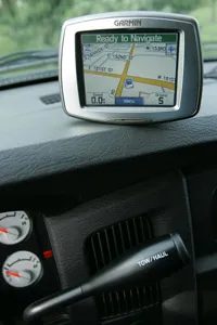
You’ve probably seen the title. Drivers plowing into lakes or slides off a cliff when told by a glowing screen to turn left into a swamp. It sounds like hyperbole until the navigation system directs you to a closed side road or the wrong lane on a divided highway.
Dependence on these devices has skyrocketed. By 2012, the number of GPS phones in use worldwide was projected to hit 560 million, compared to 175 million in 2007. We treat these devices like infallible co-pilots. We followed their step-by-step instructions without question. But this trust can be dangerous. GPS is not foolproof. To understand why it can mislead you, we need to dig deeper into how it actually works.
How satellite positioning actually works
At its core, the GPS receiver uses signals from satellite constellations and ground stations to calculate the position. This device triangulates your location based on the time it takes for signals from multiple satellites to arrive. The coordinate points are then superimposed on the digital map stored in the hardware.
The important thing here is that a GPS device is only as good as the data feeding it. No matter how much you spend on top-of-the-line hardware, you can’t fix faulty signals or outdated maps.
Accuracy difference
The first major shortcoming is the satellite signal itself. It is not precise enough to achieve precise accuracy. Even under ideal conditions, the typical error range is 164 to 328 feet (50 to 100 meters). In dense urban canyons where tall buildings blocking the sky, the margin of error increases. Your device might think you’re in the right lane, but you might actually be 100 feet away from where you see it on the screen.
Outdated digital maps
The second strike is arguably worse: Digital maps become obsolete quickly. The routes your device suggests are generated by mapping companies that license their data to device manufacturers. If that data hasn’t been updated recently, your GPS device will navigate based on a reality that no longer exists.
Roads change. New highways open. Old ones close. Traffic patterns shift. Even if the map database is out of date, this device will confidently guide you on a path that ended three years ago. It won’t know. It only knows what it was told.
When trust becomes dangerous
So when does something go wrong? Often it’s a combination of bad geometry and outdated data. You may be directed to a relocated destination or asked to turn at an intersection that was reconfigured last month. The device doesn’t question the input. Just run the code.
That’s why GPS driving directions can sometimes mislead you. The technology is powerful, but it lacks context. You won’t know if the road is closed for construction unless someone manually updates the map file. It doesn’t know if the bridge ahead is out of service. You only see dots and lines on the screen.
Understanding these limitations is the first step to safe driving. You have to look up. You have to verify. Because the machine doesn’t care if you hit a tree.
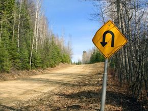

You wouldn’t trust a map from 1998 for navigating Los Angeles. But many drivers still rely on GPS software that hasn’t been updated since the Bush administration. result? The map doesn’t recognize new buildings, so you end up on roads that no longer exist, or missing junctions.
Roads change quickly. About 40% of the road infrastructure changes every year. A new route has been opened. Others are closed for months. Digital map companies were unable to update their databases immediately. They rely on ground staff driving collection vehicles, user reports and satellite data. Still, the gap remains. According to a study by the Navigation Systems Research Foundation, GPS systems often miss important details such as the type of road. This is important if the device guides a bus through a narrow residential street or steers a car on a dirt road.
But here’s the problem. Maps are not always to blame. Users often have old information in their possession.
Keep your map up to date
Most standalone GPS devices and handheld devices can be upgraded for free. Just connect your device or its memory card to the computer. You can download the latest map data directly from the service provider. Do this regularly. The accuracy of the routing depends on it.
Even with perfect data, your device is at the mercy of space. Satellite networks are error prone. Atmospheric conditions in the ionosphere and troposphere (such as changes in plasma, temperature, pressure and humidity) can affect the calculation results. When a satellite loses its position, an ephemeris or orbital error occurs. The link to the device is broken.
Signal interference is also a common cause. Something is blocking the line of sight between the GPS and the satellites. Tall buildings, dense trees, mountains, and even reflective surfaces can cause this problem. Without clear signals, your location is left to guesswork.
Fix GPS errors
Don’t get stuck if your GPS takes you on the wrong road. Major map providers such as Navteq and Tele Atlas provide users with tools to edit the data. You can report a wrong address or add missing streets. The system does not accept anything. The feedback is checked before it is added to the database. Don’t invent neighborhoods.
Update your map regularly to get from point A to point B. And keep a paper map in your glove compartment.